
File:Southeastern Australia (MODIS).jpg

預覽大小:729 × 599 像素。 其他解析度:292 × 240 像素 | 584 × 480 像素 | 934 × 768 像素 | 1,246 × 1,024 像素 | 1,434 × 1,179 像素。
原始檔案 (1,434 × 1,179 像素,檔案大小:775 KB,MIME 類型:image/jpeg)
.jpg?uselang=zh-tw)
.jpg?uselang=zh-tw)
.jpg?action=history&uselang=zh-tw)
.jpg)
摘要
| 描述 |
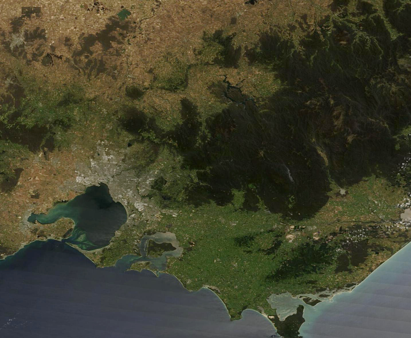
English: On December 19, 2022, the skies were clear over Southeastern Australia when the Moderate Resolution Imaging Spectroradiometer (MODIS) on board NASA’s Terra satellite acquired a true-color image of the region. The two states visible are Victoria, which sits in the south along the Bass Strait, and New South Wales, in the north. The Murray River forms the border between the two states and, because of recent heavy rains, can easily be seen meandering from west to east.
Along the southern coast, the city of Melbourne appears as a mass of gray pixels wrapping around the huge Port Phillip Bay. Just east of Melbourne the land rises into the Yarra Ranges, a mountainous area of cool temperature forest between the city and the more easterly Victorian Alps. The Yarra Ranges National Park is home to the world’s tallest flowering tree, the Mountain Ash. In the lower elevations of the Yarra Valley, fertile red soil and a cool climate spurs grape cultivation and the production of wine, especially Chardonnay, Pinot Noir, and sparkling wine. |
||
| 日期 | 攝於2022年12月19日 | ||
| 來源 |
Southeastern Australia (direct link)
|
||
| 作者 | MODIS Land Rapid Response Team, NASA GSFC |
| This media is a product of the Terra mission Credit and attribution belongs to the mission team, if not already specified in the "author" row |
授權條款
| 本作品由NASA創作,屬於公有領域。根據NASA的版權政策:“NASA的創作除非另有聲明否則不受版權保護。”(參見:Template:PD-USGov/zh,NASA版權政策或JPL圖像使用政策) | ||
 |
警告:
|
檔案歷史
點選日期/時間以檢視該時間的檔案版本。
| 日期/時間 | 縮圖 | 尺寸 | 使用者 | 備註 | |
|---|---|---|---|---|---|
| 目前 | 2023年8月9日 (三) 15:06 | | 1,434 × 1,179(775 KB) | OptimusPrimeBot | #Spacemedia - Upload of http://modis.gsfc.nasa.gov/gallery/images/image12262022_250m.jpg via Commons:Spacemedia |
檔案用途
下列頁面有用到此檔案:
.jpg)