
File:Oceania (orthographic projection).svg

此 SVG 檔案的 PNG 預覽的大小:541 × 541 像素。 其他解析度:240 × 240 像素 | 480 × 480 像素 | 768 × 768 像素 | 1,024 × 1,024 像素 | 2,048 × 2,048 像素。
原始檔案 (SVG 檔案,表面大小:541 × 541 像素,檔案大小:63 KB)
.svg?uselang=zh-tw)
.svg?uselang=zh-tw)
.svg?action=history&uselang=zh-tw)
.svg)
摘要
| 描述 |
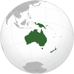
English: Orthographic map of Oceania. |
| 日期 | |
| 來源 | 我個人以下列物件為基礎來創作: Australia (orthographic projection).svg |
| 作者 | Ch1902 |
| SVG開發 |
.svg)
授權條款
我,本作品的著作權持有者,決定用以下授權條款發佈本作品:
此檔案採用創用CC 姓名標示-相同方式分享 3.0 未在地化版本授權條款。
- 您可以自由:
- 分享 – 複製、發佈和傳播本作品
- 重新修改 – 創作演繹作品
- 惟需遵照下列條件:
- 姓名標示 – 您必須指名出正確的製作者,和提供授權條款的連結,以及表示是否有對內容上做出變更。您可以用任何合理的方式來行動,但不得以任何方式表明授權條款是對您許可或是由您所使用。
- 相同方式分享 – 若要根據本素材進行再混合、轉換或創作,則必須以與原作相同或相容的授權來發布您的作品。

|
已授權您依據自由軟體基金會發行的無固定段落、封面文字和封底文字GNU自由文件授權條款1.2版或任意後續版本,對本檔進行複製、傳播和/或修改。該協議的副本列在GNU自由文件授權條款中。 |
您可以選擇您需要的授權條款。
檔案歷史
點選日期/時間以檢視該時間的檔案版本。
.svg&variant=zh-tw&dir=prev)
.svg&variant=zh-tw&offset=20221204003112)
.svg&variant=zh-tw&offset=&limit=20)
.svg&variant=zh-tw&offset=&limit=50)
.svg&variant=zh-tw&offset=&limit=100)
.svg&variant=zh-tw&offset=&limit=250)
.svg&variant=zh-tw&offset=&limit=500)
| 日期/時間 | 縮圖 | 尺寸 | 使用者 | 備註 | |
|---|---|---|---|---|---|
| 目前 | 2023年2月6日 (一) 18:54 | | 541 × 541(63 KB) | Golden Mage | A change to the map of Asia will first face debate from others. Hence, a change to the commonly accepted map of Oceania cannot be made without a wider consensus. |
| 2023年2月6日 (一) 06:33 |  | 541 × 541(108 KB) | Kwamikagami | rv: then perhaps we need to change the Asia map to match. This is as defined in WP. | |
| 2023年2月5日 (日) 18:19 |  | 541 × 541(63 KB) | Golden Mage | Reverted to the map that displays the more accepted definition of Oceania's boundaries. Widely accepted geopolitical definitions take precedence over mere geographical ones. The map of the Wikipedia page for Asia already includes the Maluku Islands. | |
| 2023年2月5日 (日) 05:01 |  | 541 × 541(108 KB) | Treetoes023 | Reverted to version as of 06:27, 24 December 2022 (UTC) | |
| 2023年2月5日 (日) 05:00 |  | 541 × 541(63 KB) | Treetoes023 | Reverted to version as of 13:25, 31 December 2022 (UTC) | |
| 2023年2月5日 (日) 04:55 |  | 541 × 541(108 KB) | Treetoes023 | Reverted to version as of 00:31, 4 December 2022 (UTC) | |
| 2022年12月31日 (六) 13:25 |  | 541 × 541(63 KB) | Golden Mage | Reverted to the map that displays the more accepted definition of Oceania's boundaries. Widely accepted geopolitical definitions take precedence over mere geographical ones. | |
| 2022年12月24日 (六) 06:27 |  | 541 × 541(108 KB) | Kwamikagami | Reverted to version as of 00:31, 4 December 2022 (UTC) definition per WP-en | |
| 2022年12月22日 (四) 06:13 |  | 541 × 541(63 KB) | Golden Mage | Reverted to the map that displays the more accepted definition of Oceania's boundaries. | |
| 2022年12月4日 (日) 00:31 |  | 541 × 541(108 KB) | Kwamikagami | the Weber line divides Oceanic from Asian Wallacea |
檔案用途
超過 100 個頁面有用到此檔案。 下列清單只列出前 100 筆有用到此檔案的頁面。 您也可以檢視完整清單。
.svg)
- 世界
- 世界各国和地区面积列表
- 世界政區索引
- 世界概况
- 东帝汶
- 中途島
- 亚洲
- 亚特兰蒂斯
- 前進澳洲美之國
- 北美洲
- 北马里亚纳群岛
- 北马里亚纳群岛总督
- 南美洲
- 印度尼西亚
- 印度次大陸
- 國家元首
- 國家圖書館
- 圖瓦盧
- 圣诞岛
- 基础教育
- 基里巴斯
- 大學
- 大洋洲
- 天佑國王
- 天佑新西兰
- 奥塔哥大区
- 姆大陆
- 威克島
- 学校
- 宪法
- 密克罗尼西亚联邦
- 属地
- 巴布亚新几内亚
- 巴布亚新几内亚国徽
- 巴布亚新几内亚总理
- 帕邁拉環礁
- 帛琉
- 库克群岛
- 应试教育
- 復活節島
- 性教育
- 我們,我們,我們
- 所罗门群岛
- 所罗门群岛总理
- 托克劳
- 教育
- 教育哲學
- 教育家
- 教育心理学
- 教育科技
- 教育经济学
- 数学教育
- 斐濟
- 新喀里多尼亞
- 新西兰
- 新西兰国旗
- 新西兰大学列表
- 新西兰总理
- 東加
- 欧洲
- 民主學校
- 法国总统
- 法屬玻里尼西亞
- 洲
- 澳大利亚
- 澳大利亚国旗
- 澳大利亚大学列表
- 澳大利亞總理
- 特殊教育
- 玻里尼西亞
- 珊瑚海群岛
- 瓦利斯和富圖納
- 瓦努阿图
- 皮特凯恩群岛
- 科科斯(基林)群島
- 紐埃
- 约翰斯顿环礁
- 美国国歌
- 美国总统
- 美屬薩摩亞
- 美洲
- 职业教育
- 自主學習
- 萨摩亚
- 行政区划
- 語言教育
- 諾魯
- 豪兰和贝克群岛
- 豪蘭島
- 貝克島
- 賈維斯島
- 金曼礁
- 閱讀教育
- 關島
- 阿什莫尔和卡捷群岛
- 非洲
- 馬紹爾群島
- 馬賽曲
- Template:大洋洲
- Template:洲
檢視連結到這個檔案的更多連結。
全域檔案使用狀況
以下其他 wiki 使用了這個檔案:
- ab.wikipedia.org 的使用狀況
- ady.wikipedia.org 的使用狀況
- af.wikipedia.org 的使用狀況
- Afrika
- Asië
- Europa
- Kiribati
- Noord-Amerika
- Suid-Amerika
- Vanuatu
- Guam
- Nieu-Seeland
- Sjabloon:Kontinente
- Australië
- Nauru
- Wellington, Nieu-Seeland
- Hoofstad
- Lys van hoofstede
- Sjabloon:Lande van Oseanië
- Honolulu
- Antarktika
- Gondwana
- Eurasië
- Laurasië
- Kategorie:Lande in Oseanië
- Lys van lande
- Fidji
- Canberra
- Hawaii
- Lys van nasionale leuses
- Clipperton
- Oseanië
- Norfolkeiland
- Amerikas
- Tonga
- Tuvalu
- Sjabloon:Hoofstede in Oseanië
- Palau
- Australië (kontinent)
- Afrika-Eurasië
- Samoa
- Marshalleilande
- Salomonseilande
- Papoea-Nieu-Guinee
- Gefedereerde State van Mikronesië
- Nukuʻalofa
- Port Moresby
- Apia
- Funafuti
- Honiara
- Majuro
檢視此檔案的更多全域使用狀況。
.svg)
.svg)