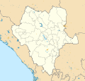
File:Mexico Durango location map (urban areas).svg
外觀

此 SVG 檔案的 PNG 預覽的大小:561 × 535 像素。 其他解析度:252 × 240 像素 | 503 × 480 像素 | 805 × 768 像素 | 1,074 × 1,024 像素 | 2,148 × 2,048 像素。
原始檔案 (SVG 檔案,表面大小:561 × 535 像素,檔案大小:837 KB)
檔案歷史
點選日期/時間以檢視該時間的檔案版本。
| 日期/時間 | 縮圖 | 尺寸 | 使用者 | 備註 | |
|---|---|---|---|---|---|
| 目前 | 2015年7月16日 (四) 19:43 |  | 561 × 535(837 KB) | Addicted04 | No rivers |
| 2015年7月16日 (四) 19:37 |  | 561 × 535(1.48 MB) | Addicted04 | User created page with UploadWizard |
檔案用途
全域檔案使用狀況
以下其他 wiki 使用了這個檔案:
- en.wikipedia.org 的使用狀況
- es.wikipedia.org 的使用狀況
- Anexo:Patrimonio de la Humanidad en México
- Aeropuerto Internacional de Durango
- Parque temático Villas del Oeste
- Plantilla:Mapa de localización de Durango
- Anexo:Pueblos mágicos
- Aeródromo General Jesús Agustín Castro
- Museo de Arqueología Ganot-Peschard
- Aeródromo de Tayoltita
- Aeródromo de Rancho El Durangueño
- Aeródromo de Tamazula
- Aeródromo de Galancita
- ja.wikipedia.org 的使用狀況
- lv.wikipedia.org 的使用狀況
- si.wikipedia.org 的使用狀況

