
File:Map of les saintes.gif
此為最大尺寸。
Map_of_les_saintes.gif (500 × 369 像素,檔案大小:14 KB,MIME 類型:image/gif)
摘要
| 描述 |
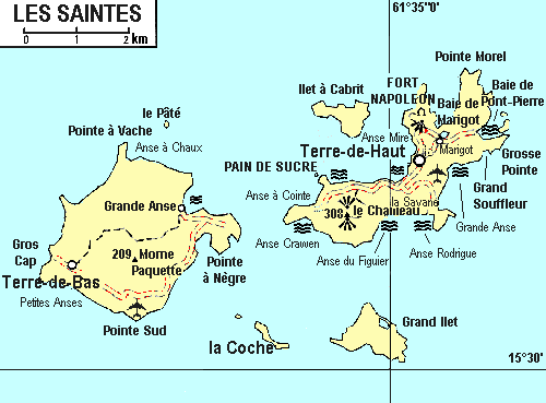
English: map of les Saintes, from 1993 |
| 日期 | |
| 來源 | Guide Visa-En Guadeloupe, 1993 |
| 作者 | Hachette Livre |
授權條款
| 此檔案於創用 CC CC0 1.0 通用公有領域貢獻宣告下分發。 | |
| 在此宣告之下分發本作品者,已依據各國著作權法,在全世界放棄其對本作品所擁有的著作權及所有相關相似的法律權利,從而將本作品貢獻至公有領域。您可以複製、修改、分發和演示該作品,用於任何商業用途,所有這些都不需要請求授權。
|
檔案歷史
點選日期/時間以檢視該時間的檔案版本。
| 日期/時間 | 縮圖 | 尺寸 | 使用者 | 備註 | |
|---|---|---|---|---|---|
| 目前 | 2011年12月4日 (日) 23:32 | | 500 × 369(14 KB) | Moowgly |
檔案用途
下列頁面有用到此檔案:
全域檔案使用狀況
以下其他 wiki 使用了這個檔案:
- de.wikipedia.org 的使用狀況
- el.wikipedia.org 的使用狀況
- en.wikipedia.org 的使用狀況
- Îles des Saintes
- Terre-de-Bas Island
- Terre-de-Haut Island
- Îlet à Cabrit
- Grand-Îlet
- Pompierre, Terre-de-Haut
- Marigot, Terre-de-Haut
- Vieille Anse, Terre-de-Haut
- Fort Napoléon, Terre-de-Haut
- Maison blanche, Terre-de-Haut
- La Coulée, Terre-de-Haut
- Coquelet, Terre-de-Haut
- Anse Mire
- Mouillage, Terre-de-Haut
- Grande-Anse, Terre-de-Haut
- Fond-du-Curé
- La Savane, Terre-de-Haut
- Anse Rodrigue, Terre-de-Haut
- Anse Galet, Terre-de-Haut
- Prés Cassin, Terre-de-Haut
- La Convalescence, Terre-de-Haut
- Anse Figuier, Terre-de-Haut
- Pain-de-Sucre
- Anse à Cointe, Terre-de-Haut
- Anse Crawen, Terre-de-Haut
- Anse des Mûriers, Terre-de-Bas
- Grande-Anse, Terre-de-Bas
- Grand-Baie, Terre-de-Bas
- Petite-Anse, Terre-de-Bas
- Le Mapou, Terre-de-Bas
- it.wikipedia.org 的使用狀況
- ja.wikipedia.org 的使用狀況
- nl.wikipedia.org 的使用狀況
- pt.wikipedia.org 的使用狀況
- ru.wikipedia.org 的使用狀況
- uk.wikipedia.org 的使用狀況
- ur.wikipedia.org 的使用狀況
- vi.wikipedia.org 的使用狀況
- www.wikidata.org 的使用狀況