
File:Map of Halifax County North Carolina With Municipal and Township Labels.PNG

預覽大小:740 × 600 像素。 其他解析度:296 × 240 像素 | 593 × 480 像素 | 817 × 662 像素。
原始檔案 (817 × 662 像素,檔案大小:68 KB,MIME 類型:image/png)
摘要
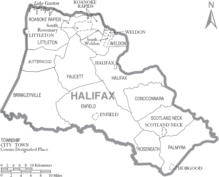
| 描述 | Map of Halifax County, North Carolina, United States with township and municipal boundaries |
| 日期 | |
| 來源 | taken from US Census website [1] and modified by User:Ruhrfisch |
| 作者 | US Census, Ruhrfisch |
| 授權許可 (重用此檔案) |
US Census / US Government work is public domain, my modifications licensed under the GNU Free Documentation License |
授權條款
I, Ruhrfisch,此作品的版權所有人,決定用以下授權條款發佈本作品:

|
已授權您依據自由軟體基金會發行的無固定段落、封面文字和封底文字GNU自由文件授權條款1.2版或任意後續版本,對本檔進行複製、傳播和/或修改。該協議的副本列在GNU自由文件授權條款中。 |
| 此檔案採用創用CC 姓名標示-相同方式分享 3.0 未在地化版本授權條款。 | ||
姓名標示:
I, Ruhrfisch | ||
| ||
| 已新增授權條款標題至此檔案,作為GFDL授權更新的一部份。 |
此檔案採用創用CC 姓名標示-相同方式分享 2.5 通用版授權條款。
姓名標示:
I, Ruhrfisch
- 您可以自由:
- 分享 – 複製、發佈和傳播本作品
- 重新修改 – 創作演繹作品
- 惟需遵照下列條件:
- 姓名標示 – 您必須指名出正確的製作者,和提供授權條款的連結,以及表示是否有對內容上做出變更。您可以用任何合理的方式來行動,但不得以任何方式表明授權條款是對您許可或是由您所使用。
- 相同方式分享 – 若要根據本素材進行再混合、轉換或創作,則必須以與原作相同或相容的授權來發布您的作品。
您可以選擇您需要的授權條款。
and
This image or file is a work of a United States Census Bureau employee, taken or made as part of that person's official duties. As a work of the U.S. federal government, the image is in the public domain.
|
 |
檔案歷史
點選日期/時間以檢視該時間的檔案版本。
| 日期/時間 | 縮圖 | 尺寸 | 使用者 | 備註 | |
|---|---|---|---|---|---|
| 目前 | 2007年7月11日 (三) 14:06 | | 817 × 662(68 KB) | Ruhrfisch | {{Information| |Description= Map of Halifax County, North Carolina, United States with township and municipal boundaries |Source= taken from US Census website [http://www2.census.gov/geo/maps/general_ref/cousub_outline/cen2k_pgsz/nc_cosub.pdf] and modifi |
檔案用途
下列12個頁面有用到此檔案:
全域檔案使用狀況
以下其他 wiki 使用了這個檔案:
- en.wikipedia.org 的使用狀況
- es.wikipedia.org 的使用狀況
- ja.wikipedia.org 的使用狀況
- nl.wikipedia.org 的使用狀況