File:Partition of India 1947 en.svg
外观

此SVG文件的PNG预览的大小:609 × 599像素。 其他分辨率:244 × 240像素 | 488 × 480像素 | 780 × 768像素 | 1,041 × 1,024像素 | 2,081 × 2,048像素 | 1,189 × 1,170像素。
原始文件 (SVG文件,尺寸为1,189 × 1,170像素,文件大小:701 KB)
文件历史
点击某个日期/时间查看对应时刻的文件。
| 日期/时间 | 缩略图 | 大小 | 用户 | 备注 | |
|---|---|---|---|---|---|
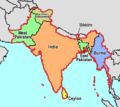
| 当前 | 2025年1月17日 (五) 09:19 | 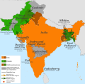 | 1,189 × 1,170(701 KB) | Jordi escarre | File uploaded using svgtranslate tool (https://svgtranslate.toolforge.org/). Added translation for ca. |
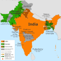
| 2017年7月5日 (三) 13:15 |  | 1,189 × 1,170(724 KB) | RaviC | some rendering adjustments | |
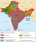
| 2017年7月5日 (三) 13:14 |  | 1,189 × 1,170(717 KB) | RaviC | + Gwadar | |
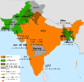
| 2017年4月30日 (日) 02:57 |  | 1,189 × 1,170(661 KB) | फ़िलप्रो | Kalat and Dadra and Nagar Haveli border width. | |
| 2017年4月30日 (日) 02:46 |  | 1,189 × 1,170(648 KB) | फ़िलप्रो | Fixed Junagadh, location of Diu (Daman and Diu), and added Dadra and Nagar Haveli. | |
| 2017年4月30日 (日) 01:31 |  | 1,189 × 1,170(643 KB) | फ़िलप्रो | Added labels for other annexed princely states. Fixed shape of Bengal and Punjab provinces as per their sizes in 1947. | |
| 2017年2月11日 (六) 12:17 |  | 1,189 × 1,170(433 KB) | Superbenjamin | User created page with UploadWizard |
文件用途
全域文件用途
以下其他wiki使用此文件:
- af.wikipedia.org上的用途
- als.wikipedia.org上的用途
- arz.wikipedia.org上的用途
- ast.wikipedia.org上的用途
- az.wikipedia.org上的用途
- bg.wikipedia.org上的用途
- ca.wikipedia.org上的用途
- da.wikipedia.org上的用途
- de.wikipedia.org上的用途
- de.wikiversity.org上的用途
- el.wikipedia.org上的用途
- en.wikipedia.org上的用途
- es.wikipedia.org上的用途
- eu.wikipedia.org上的用途
- fi.wikipedia.org上的用途
- ga.wikipedia.org上的用途
- he.wikipedia.org上的用途
- hy.wikipedia.org上的用途
- id.wikipedia.org上的用途
- is.wikipedia.org上的用途
- ja.wikipedia.org上的用途
- ka.wikipedia.org上的用途
- ko.wikipedia.org上的用途
- lv.wikipedia.org上的用途
- ml.wikipedia.org上的用途
查看此文件的更多全域用途。


