
File:Map of Tuscarawas County Ohio With Municipal and Township Labels.PNG
預覽大小:426 × 599 像素。 其他解析度:171 × 240 像素 | 486 × 683 像素。
原始檔案 (486 × 683 像素,檔案大小:61 KB,MIME 類型:image/png)
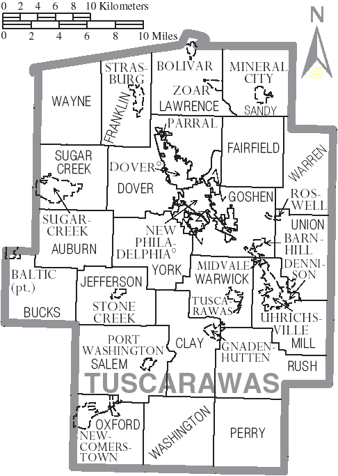
| 描述 | Map of Tuscarawas County, Ohio, United States with township and municipal boundaries |
| 日期 | |
| 來源 | taken from US Census website [1] and modified by User:Ruhrfisch |
| 作者 | US Census, Ruhrfisch |
| 授權許可 (重用此檔案) |
US Census / US Government work is public domain, my modifications licensed under the GNU Free Documentation License |

|
已授權您依據自由軟體基金會發行的無固定段落、封面文字和封底文字GNU自由文件授權條款1.2版或任意後續版本,對本檔進行複製、傳播和/或修改。該協議的副本列在GNU自由文件授權條款中。 |
| 此檔案採用共享創意 姓名標示-相同方式分享 3.0 未在地化版本授權條款。 | ||
| ||
| 已新增授權條款標題至此檔案,作為GFDL授權更新的一部份。 |
檔案歷史
點選日期/時間以檢視該時間的檔案版本。
| 日期/時間 | 縮圖 | 尺寸 | 用戶 | 備註 | |
|---|---|---|---|---|---|
| 目前 | 2006年7月3日 (一) 20:22 | | 486 × 683(61 KB) | Ruhrfisch | {{Information| |Description= Map of Tuscarawas County, Ohio, United States with township and municipal boundaries |Source= taken from US Census website [http://www2.census.gov/geo/maps/general_ref/cousub_outline/cen2k_pgsz/oh_cosub.pdf] and modified by [ |
檔案用途
下列頁面有用到此檔案:
全域檔案使用狀況
以下其他 wiki 使用了這個檔案:
- de.wikipedia.org 的使用狀況
- en.wikipedia.org 的使用狀況
- es.wikipedia.org 的使用狀況
- it.wikipedia.org 的使用狀況
- ja.wikipedia.org 的使用狀況
- nl.wikipedia.org 的使用狀況
- pt.wikipedia.org 的使用狀況
- simple.wikipedia.org 的使用狀況
- ur.wikipedia.org 的使用狀況