
File:Map-of-Ottoman-Empire-in-1900-Latvian.svg

此 SVG 檔案的 PNG 預覽的大小:800 × 504 像素。 其他解析度:320 × 201 像素 | 640 × 403 像素 | 1,024 × 644 像素 | 1,280 × 806 像素 | 2,560 × 1,611 像素 | 885 × 557 像素。
原始檔案 (SVG 檔案,表面大小:885 × 557 像素,檔案大小:103 KB)
摘要
Kopsavilkums
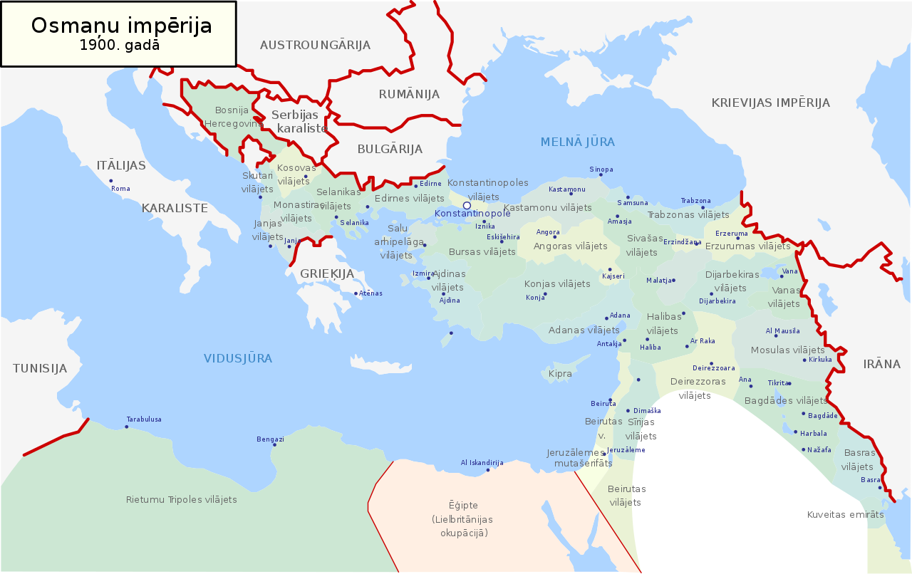
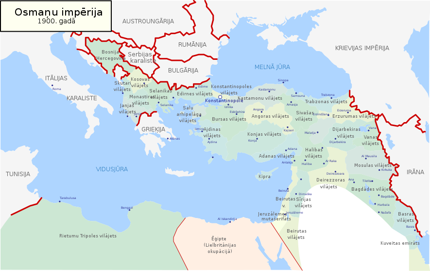
| 描述 | Map of Ottoman Empire (1900) in Latvian |
| 日期 | |
| 來源 | 自己的作品 |
| 作者 | Juris Tiltins |
| 授權許可 (重用此檔案) |
Free use and distribution permitted. |
| 其他版本 |
Map-of-Ottoman-Empire-in-1900-Latvian.svg[]
|


授權條款
| 我,此作品的版權所有人,釋出此作品至公共領域。此授權條款在全世界均適用。 這可能在某些國家不合法,如果是的話: 我授予任何人有權利使用此作品於任何用途,除受法律約束外,不受任何限制。 |
檔案歷史
點選日期/時間以檢視該時間的檔案版本。
| 日期/時間 | 縮圖 | 尺寸 | 用戶 | 備註 | |
|---|---|---|---|---|---|
| 目前 | 2018年5月18日 (五) 17:05 | | 885 × 557(103 KB) | NordNordWest | Reverted to version as of 21:53, 30 January 2008 (UTC) |
| 2018年5月18日 (五) 17:04 |  | 885 × 557(113 KB) | NordNordWest | + Sicilia, Sardegna, Corse, Malta | |
| 2008年1月30日 (三) 21:53 |  | 885 × 557(103 KB) | Juristiltins | {{Information |Description=Map of Ottoman Empire (1900) in Latvian |Source=own work |Date=30 January 2008 |Author=Juris Tiltins |Permission=Free use and distribution permitted. |other_versions= }} Category:Maps of the Ottoman Empire |
檔案用途
沒有使用此檔案的頁面。
全域檔案使用狀況
以下其他 wiki 使用了這個檔案:
- de.wikipedia.org 的使用狀況
- lv.wikipedia.org 的使用狀況