
File:MEX orthographic.svg

此 SVG 檔案的 PNG 預覽的大小:600 × 600 像素。 其他解析度:240 × 240 像素 | 480 × 480 像素 | 768 × 768 像素 | 1,024 × 1,024 像素 | 2,048 × 2,048 像素 | 802 × 802 像素。
原始檔案 (SVG 檔案,表面大小:802 × 802 像素,檔案大小:10.07 MB)
摘要
English: This map (in {ISO} orthographic.svg format) is part of the Spanish Wikipedia style conventions. Please do not edit unless a consensus has been reached on the Spanish Wikipedia. If the conventions of other wikis are violated, upload an alternative version or use other available maps.
Español: Este mapa (en formato {ISO} orthographic.svg) forma parte de las convenciones de estilo de Wikipedia en español. Por favor, no editar a menos que se haya llegado a un concenso en Wikipedia en español. En caso de que se incumplan convenciones de otras wikis, subir una versión alternativa o usar otros mapas disponibles.
| 描述 |
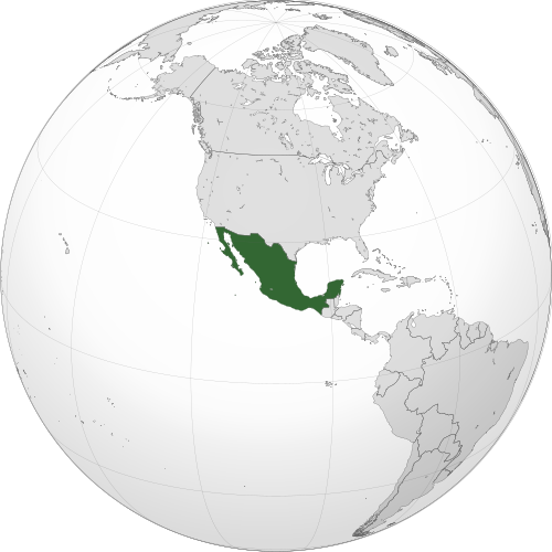
English: A map of the hemisphere centred on 23°, -102°, using an orthographic projection. Mexico is highlighted in green. Solid areas represent sovereign territories. In the exclusive economic zone (EEZ) the state does not have full sovereignty, but rather "sovereign rights". Dashed areas represent disputed territories or unrecognized territories.
Sources:
Software used: Español: Mapa del hemisferio centrado en 23°, -102°, usando una proyección ortográfica. México está resaltado en verde. Los colores sólidos representan territorios soberanos. En las zonas económicas exclusivas (ZEE) el estado no tiene soberanía absoluta, pero tiene "derechos de soberanía". Las áreas discontinuas representan territorios en disputa o no reconocidos.
Fuentes:
Software usado: |
| 日期 | |
| 來源 | 自己的作品 |
| 作者 | David Ayala |
| SVG開發 |
授權條款
我,本作品的著作權持有者,決定用以下授權條款發佈本作品:
此檔案採用創用CC 姓名標示-相同方式分享 3.0 未在地化版本授權條款。
- 您可以自由:
- 分享 – 複製、發佈和傳播本作品
- 重新修改 – 創作演繹作品
- 惟需遵照下列條件:
- 姓名標示 – 您必須指名出正確的製作者,和提供授權條款的連結,以及表示是否有對內容上做出變更。您可以用任何合理的方式來行動,但不得以任何方式表明授權條款是對您許可或是由您所使用。
- 相同方式分享 – 若要根據本素材進行再混合、轉換或創作,則必須以與原作相同或相容的授權來發布您的作品。
檔案歷史
點選日期/時間以檢視該時間的檔案版本。
| 日期/時間 | 縮圖 | 尺寸 | 使用者 | 備註 | |
|---|---|---|---|---|---|
| 目前 | 2025年7月17日 (四) 04:23 | | 802 × 802(10.07 MB) | Addicted04 | Don't revert. New map, EEZ, valid SVG. Please, read this, I'm the ORIGINAL AUTHOR of this file, derivated works or other can be upload as an alternative version. |
| 2025年7月13日 (日) 15:02 |  | 551 × 551(2.26 MB) | Bokmanrocks01 | Reverted to version as of 21:03, 18 January 2014 (UTC) Restore lighter borders. Better consistency between articles and clean look | |
| 2025年7月11日 (五) 19:31 |  | 792 × 792(2.29 MB) | Addicted04 | New map | |
| 2014年1月18日 (六) 21:03 |  | 551 × 551(2.26 MB) | Addicted04 | New map | |
| 2011年9月8日 (四) 00:44 |  | 550 × 550(1.05 MB) | Addicted04 | latitude line (in Russia) | |
| 2011年9月8日 (四) 00:14 |  | 550 × 550(1.06 MB) | Addicted04 |
檔案用途
全域檔案使用狀況
以下其他 wiki 使用了這個檔案:
- ami.wikipedia.org 的使用狀況
- ar.wikipedia.org 的使用狀況
- المكسيك
- مستخدم:جار الله/قائمة صور مقالات العلاقات الثنائية
- العلاقات المكسيكية الأمريكية
- العلاقات الأنغولية المكسيكية
- العلاقات المكسيكية الكورية الجنوبية
- العلاقات المكسيكية الإريترية
- العلاقات المكسيكية السويسرية
- العلاقات الألمانية المكسيكية
- العلاقات المكسيكية الليختنشتانية
- العلاقات المكسيكية البوليفية
- العلاقات المكسيكية الموزمبيقية
- العلاقات الألبانية المكسيكية
- العلاقات المكسيكية البلجيكية
- العلاقات المكسيكية الإثيوبية
- العلاقات المكسيكية البيلاروسية
- العلاقات المكسيكية الطاجيكستانية
- العلاقات المكسيكية الروسية
- العلاقات المكسيكية الرومانية
- العلاقات الأرجنتينية المكسيكية
- العلاقات المكسيكية الغامبية
- العلاقات المكسيكية القبرصية
- العلاقات المكسيكية السيراليونية
- العلاقات المكسيكية النيبالية
- العلاقات المكسيكية الليبيرية
- العلاقات التشيكية المكسيكية
- العلاقات المكسيكية الميانمارية
- العلاقات المكسيكية الزيمبابوية
- العلاقات المكسيكية الإسرائيلية
- العلاقات المكسيكية البالاوية
- العلاقات المكسيكية المالية
- العلاقات المكسيكية النيجيرية
- العلاقات المكسيكية اليمنية
- العلاقات المكسيكية الفانواتية
- العلاقات الغابونية المكسيكية
- العلاقات المكسيكية البنمية
- العلاقات المكسيكية الكوبية
- العلاقات المكسيكية الجورجية
- العلاقات المكسيكية التونسية
- العلاقات المكسيكية الكورية الشمالية
- العلاقات المكسيكية الهندية
- العلاقات المكسيكية اليابانية
- العلاقات المكسيكية الإيطالية
- العلاقات المكسيكية الناوروية
- العلاقات الأسترالية المكسيكية
- العلاقات المكسيكية الزامبية
- العلاقات المكسيكية الفيجية
- العلاقات المكسيكية المارشالية
- العلاقات الأذربيجانية المكسيكية
- العلاقات السودانية المكسيكية
檢視此檔案的更多全域使用狀況。