
File:BMHWmaps.svg

此 SVG 檔案的 PNG 預覽的大小:594 × 455 像素。 其他解析度:313 × 240 像素 | 627 × 480 像素 | 1,003 × 768 像素 | 1,280 × 980 像素 | 2,560 × 1,961 像素。
原始檔案 (SVG 檔案,表面大小:594 × 455 像素,檔案大小:69 KB)
檔案歷史
點選日期/時間以檢視該時間的檔案版本。
| 日期/時間 | 縮圖 | 尺寸 | 使用者 | 備註 | |
|---|---|---|---|---|---|
| 目前 | 2010年10月2日 (六) 02:55 | | 594 × 455(69 KB) | ICEFTP | Add map borders. |
| 2010年10月2日 (六) 02:53 |  | 594 × 455(69 KB) | ICEFTP | Update road marks. | |
| 2010年8月26日 (四) 01:03 |  | 595 × 455(64 KB) | ICEFTP | Correct some road routes. | |
| 2010年8月24日 (二) 04:36 |  | 595 × 455(65 KB) | ICEFTP | Update mark points & correct some mistakes. | |
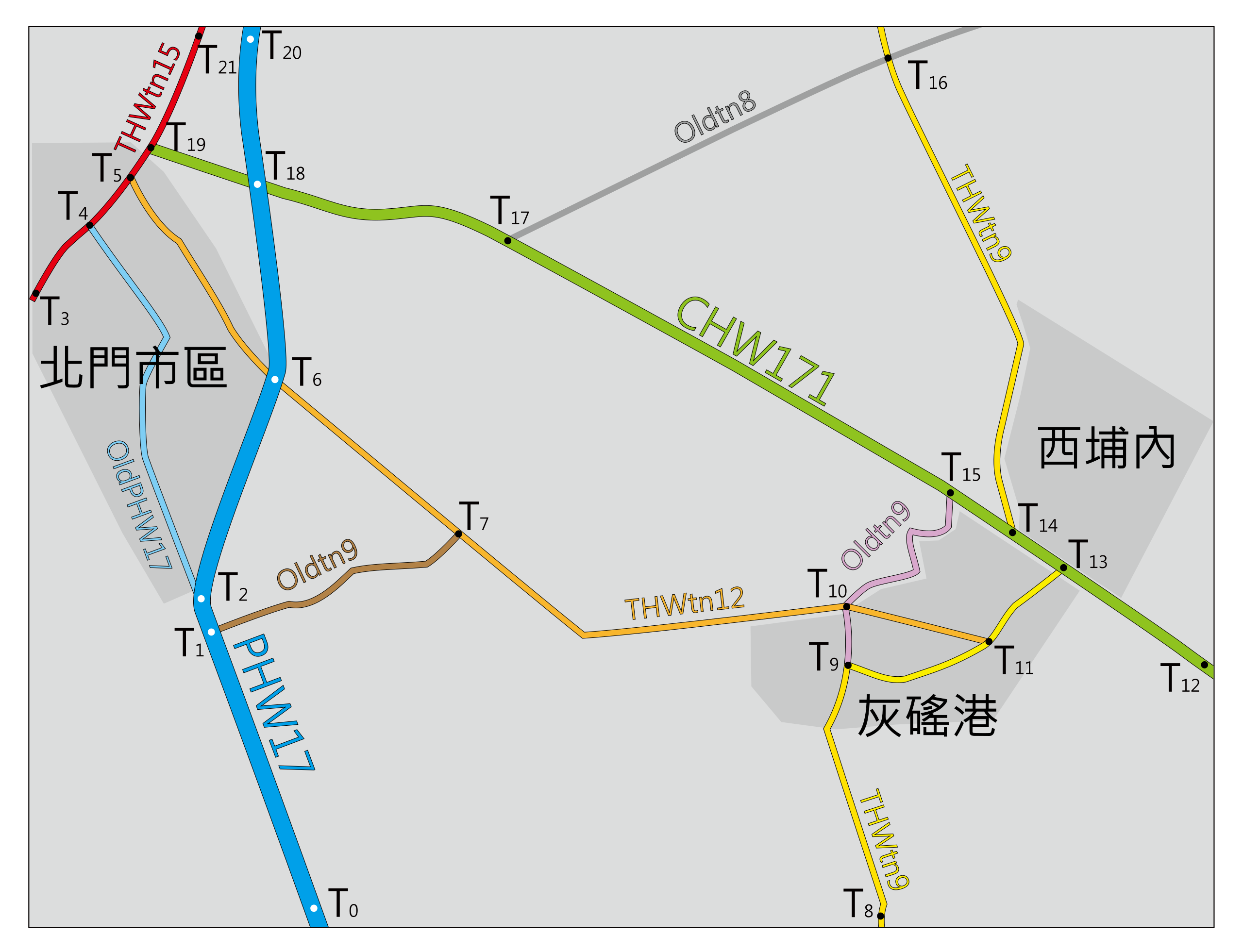
| 2010年8月24日 (二) 01:27 |  | 586 × 451(57 KB) | ICEFTP | {{Information |Description={{zh-tw|1=台南縣北門鄉公路地圖}} |Source={{own}} |Author=ICEFTP |Date=2010-08-24 |Permission={{PD-self}} |other_versions= }} Category:Maps of Tainan County Category:SVG maps of Tainan |