
File:Map of Cabarrus County North Carolina With Municipal and Township Labels.PNG
此为最大尺寸。
Map_of_Cabarrus_County_North_Carolina_With_Municipal_and_Township_Labels.PNG (528 × 425像素,文件大小:51 KB,MIME类型:image/png)
摘要
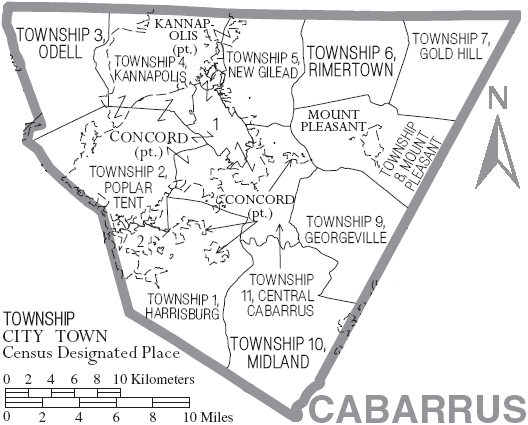
| 描述 | Map of Cabarrus County, North Carolina, United States with township and municipal boundaries |
| 日期 | |
| 来源 | taken from US Census website [1] and modified by User:Ruhrfisch |
| 作者 | US Census, Ruhrfisch |
| 授权 (二次使用本文件) |
US Census / US Government work is public domain, my modifications licensed under the GNU Free Documentation License |
许可协议
I, Ruhrfisch,本作品著作权人,特此采用以下许可协议发表本作品:

|
已授权您依据自由软件基金会发行的无固定段落及封面封底文字(Invariant Sections, Front-Cover Texts, and Back-Cover Texts)的GNU自由文件许可协议1.2版或任意后续版本的条款,复制、传播和/或修改本文件。该协议的副本请见“GNU Free Documentation License”。 |
| 本文件采用知识共享署名-相同方式共享 3.0 未本地化版本许可协议授权。 | ||
署名:
I, Ruhrfisch | ||
| ||
| 本许可协议标签作为GFDL许可协议更新的组成部分被添加至本文件。 |
本文件采用知识共享署名-相同方式共享 2.5 通用许可协议授权。
署名:
I, Ruhrfisch
- 您可以自由地:
- 共享 – 复制、发行并传播本作品
- 修改 – 改编作品
- 惟须遵守下列条件:
- 署名 – 您必须对作品进行署名,提供授权条款的链接,并说明是否对原始内容进行了更改。您可以用任何合理的方式来署名,但不得以任何方式表明许可人认可您或您的使用。
- 相同方式共享 – 如果您再混合、转换或者基于本作品进行创作,您必须以与原先许可协议相同或相兼容的许可协议分发您贡献的作品。
您可以选择您需要的许可协议。
and
This image or file is a work of a United States Census Bureau employee, taken or made as part of that person's official duties. As a work of the U.S. federal government, the image is in the public domain.
|
 |
文件历史
点击某个日期/时间查看对应时刻的文件。
| 日期/时间 | 缩略图 | 大小 | 用户 | 备注 | |
|---|---|---|---|---|---|
| 当前 | 2007年6月16日 (六) 17:55 | | 528 × 425(51 KB) | Ruhrfisch | {{Information| |Description= Map of Cabarrus County, North Carolina, United States with township and municipal boundaries |Source= taken from US Census website [http://www2.census.gov/geo/maps/general_ref/cousub_outline/cen2k_pgsz/nc_cosub.pdf] and modif |
文件用途
以下12个页面使用本文件:
全域文件用途
以下其他wiki使用此文件:
- en.wikipedia.org上的用途
- es.wikipedia.org上的用途
- ja.wikipedia.org上的用途
- nl.wikipedia.org上的用途