
File:Gana 31.03.2009 048.jpg
本预览的尺寸:800 × 449像素。 其他分辨率:320 × 180像素 | 640 × 359像素 | 1,024 × 575像素 | 1,280 × 718像素 | 2,048 × 1,149像素。
原始文件 (2,048 × 1,149像素,文件大小:287 KB,MIME类型:image/jpeg)
| 描述 |
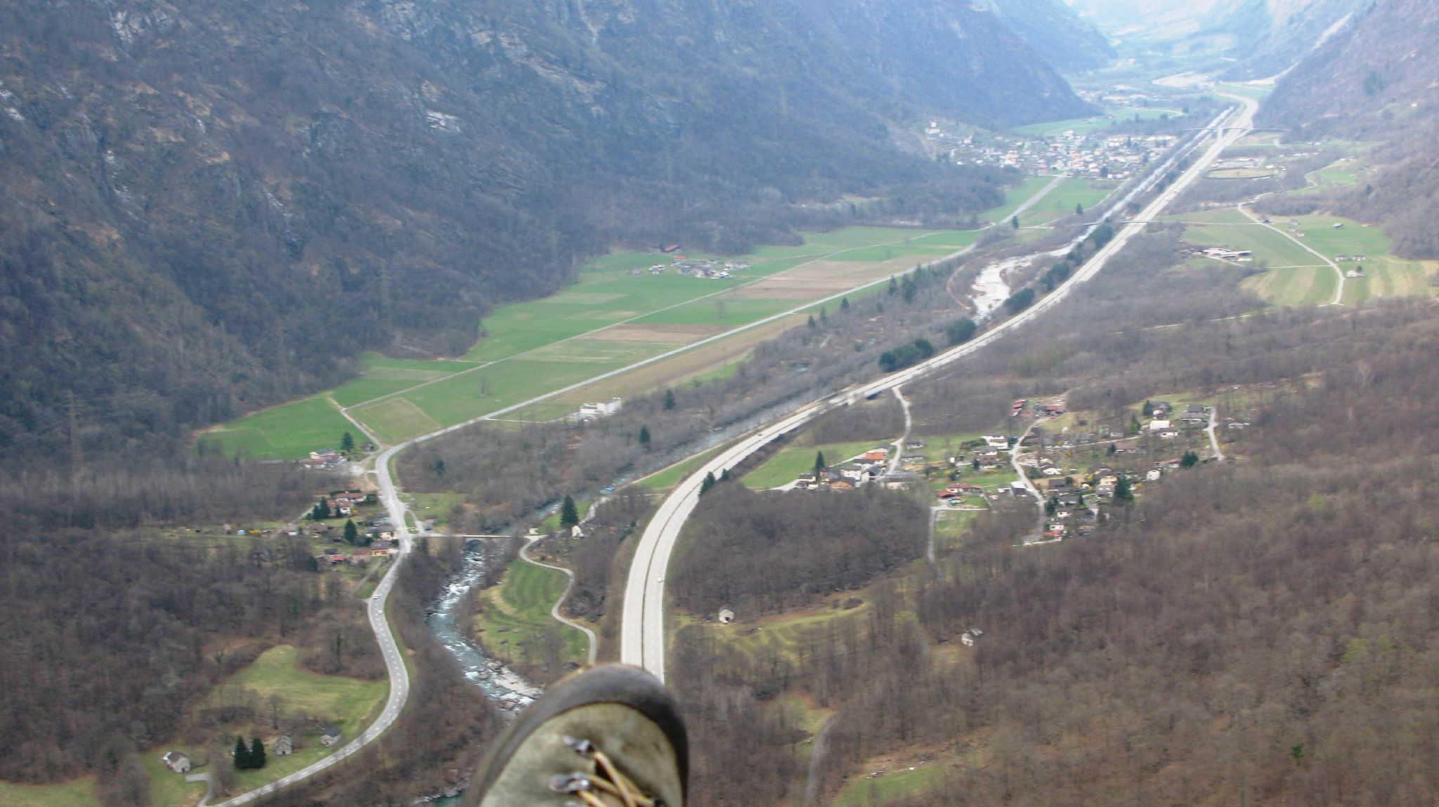
English: View from a paraglider over the plain between Sorte (in the foreground on the right of the motorway) and Lostallo (in the background on the left of the motorway) in the Swiss canton of Grisons. In the centre of the picture, between the highway and the main road 13, is the nationally important alluvial zone Rosera, through which the Moësa flows. In the background, the nationally important dry grassland/pasture Von (area of over 8 ha) is visible on the right of the motorway at the height of Lostallo. Deutsch: Blick vom Gleitschirm über die Ebene zwischen Sorte (im Vordergrund rechts der Autobahn) und Lostallo (im Hintergrund links der Autobahn) im Schweizer Kanton Graubünden. In der Bildmitte erstreckt sich zwischen der Autobahn und der Hauptstrasse 13 das national bedeutende Auengebiet Rosera, durchflossen von der Moësa. Im Hintergrund ist auf der Höhe von Lostallo rechts der Autobahn die national bedeutende Trockenwiese/-weide Von (über 8 ha) sichtbar. Français : Vue du parapente sur la plaine entre Sorte (au premier plan à droite de l'autoroute) et Lostallo (à l'arrière-plan à gauche de l'autoroute) dans le canton suisse des Grisons. Au centre de l'image, entre l'autoroute et la route principale 13, s'étend la zone alluviale d'importance nationale Rosera, traversée par la Moësa. En arrière-plan, à la hauteur de Lostallo, à droite de l'autoroute, on peut voir la prairie/le pâturage sec Von, d'importance nationale (surface de plus de 8 ha). Italiano: Vista da un parapendio sulla pianura tra Sorte (in primo piano a destra dell'autostrada) e Lostallo (sullo sfondo a sinistra dell'autostrada) nel Cantone svizzero dei Grigioni. Al centro dell'immagine, tra l'autostrada e la strada statale 13, si trova l'area golenale "Rosera", di importanza nazionale, attraverso la quale scorre il Moësa. Sullo sfondo, il prato/pascolo secco di importanza nazionale "Von" (superficie di oltre 8 ettari) è visibile sulla destra dell'autostrada all'altezza di Lostallo. |
||||||
| 日期 | |||||||
| 来源 | originally posted to Flickr as Gana 31.03.2009 048 | ||||||
| 作者 | Claudio Vosti | ||||||
| 授权 (二次使用本文件) |
本文件采用知识共享署名-相同方式共享 2.0 通用许可协议授权。
|
||||||
| Protected |
|
| 註解 | 該圖片含有註解:在維基媒體共享資源上查看註解 |
文件历史
点击某个日期/时间查看对应时刻的文件。
| 日期/时间 | 缩略图 | 大小 | 用户 | 备注 | |
|---|---|---|---|---|---|
| 当前 | 2009年10月22日 (四) 23:53 | | 2,048 × 1,149(287 KB) | Flickr upload bot | Uploaded from http://flickr.com/photo/85864219@N00/3402469410 using Flickr upload bot |
文件用途
以下页面使用本文件:
全域文件用途
以下其他wiki使用此文件:
- de.wikipedia.org上的用途
- en.wikipedia.org上的用途
- fr.wikipedia.org上的用途
- id.wikipedia.org上的用途
- lmo.wikipedia.org上的用途
- nn.wikipedia.org上的用途
- www.wikidata.org上的用途